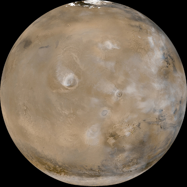
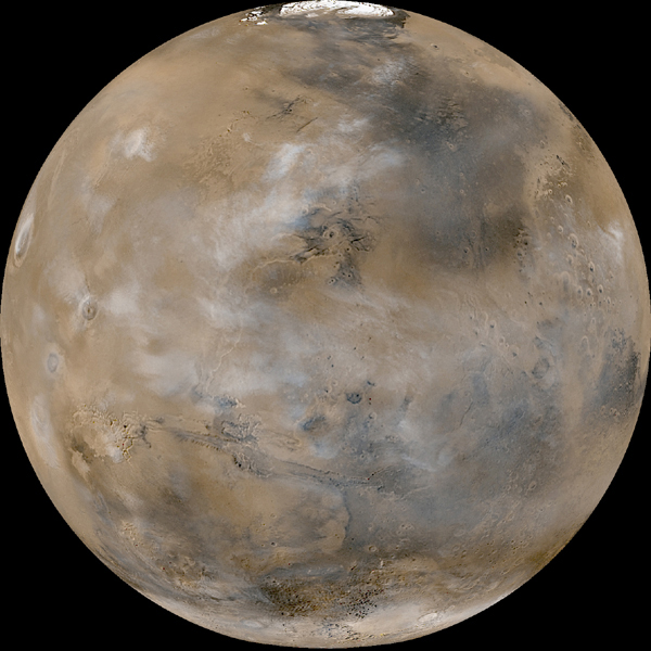
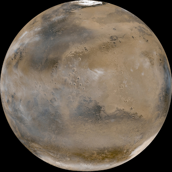
Astronomers funded by NASA are monitoring the trajectory of an asteroid estimated to be 164 feet wide that is expected to cross Mars' orbital path early next year.
The asteroid was initially being monitored by The Near Earth Object Observation Program, commonly called "Spaceguard,” to determine if any could be potentially hazardous to our planet. It was determined that the asteroid will not be a threat to earth but it may however, potentially impact mars.
Because of current uncertainties about the asteroid's exact orbit, there is a 1-in-75 chance of the asteroid impacting Mars. “We estimate such impacts occur on Mars every thousand years or so” said Steve Chesley, a scientist at JPL. If the asteroid were to collide with mars, it is calculated that it would hit at 30,000 mph and could create a crater over half a mile wide.
Friday, December 21, 2007
Monday, December 17, 2007
NASA Mars Rover Spirit Scouts "Home Plate" for Safe Haven

Monday, December 17, 2007
Spirit has arrived at the north edge of "Home Plate." The rover will spend the next few Martian days, or sols, scouting the edge of Home Plate and acquiring images of the slopes to determine the best site for "
Power levels are dropping rapidly, partly because the sun continues its retreat north on its way to winter solstice, and partly because the landscape tilts slightly southward near the rim. Drive sols are so precious and few, the team has been working long hours and weekends to make the most of the remaining sunlight.
Wednesday, December 12, 2007
Orbiter explains bizarre Mars textures
High resolution images taken form the Mars reconnaissance orbiter are helping to explain some strange textures near the planets south pole.

Previously research had described the surface of the southern region, specifically Ithaca, as having spidery, lace-like, and lizard-skin texture.
the new images are leading researchers to believe that the lighter-colored patches are caused by frozen carbon dioxide
"The researchers think the jets contain gaseous carbon dioxide. When it bursts free, it expands and cools, and some is deposited as frost in the smudges. The
darker areas are believed to be composed of dust," NASA said.
Researchers believe that the carbon dioxide freezes in the winter and thaws in the summer. Subsequently, the gas travels upward, underneath the frozen caps, and carves channels along the way.
Mars Rovers Explore Possibility of Acidic Steam
As Spirit makes its way to a wintering spot, scientists are trying to make sense of a patch of nearly pure silica the rover found. The silica was so concentrated scientists believe steam must have been involved in ways similar to geologic formations seen on Earth called fumaroles which are seen in places like Hawaii and Iceland but are different from the mineral deposits seen in hot springs. While several possibilities exist for the formation of the silica patch, the presence of titanium is indicative of fumarole-type formation. Researchers are using both rovers now to look for signs of similar patches, with hope that a find by Opportunity, on the other side of the planet, will provide more general evidence for the role of water in the planet's past. The article can be found here: http://www.sciencedaily.com/releases/2007/12/071212000742.htm
Monday, December 10, 2007
NASA and Other Nations Start Planning Mars Soil Return Mission
NASA and the space agencies of Europe, Canada, and Japan, to name a few, have begun preliminary work planning a Mars mission to return soil samples, set to launch in the next decade. The group recently met and is giving an open invitation to all space-faring nations to take part in the collaboration. The possibility of returning samples would allow scientists to do much more in depth analysis of soil composition and also testing for biological presence. The article gave no indication of a set timeframe for the mission.
Sunday, December 9, 2007
plate tectonics
NASA scientists have created a map of Mars crustal magnetism using data collected by the Mars Global Surveyor spacecraft. This high resolution magnetic field map covers the entire surface of Mars and displays "magnetic stripes" similar to what are found in the Earth's ocean basins. These stripes and other features are interpreted by NASA scientists as being evidence that Mars has undergone plate tectonics.
http://geology.com/news/2005/11/mars-geology-and-plate-tectonics.html
http://geology.com/news/2005/11/mars-geology-and-plate-tectonics.html
High Resolution Images of Noctis Labyrinthus

The High-Resolution Sterio Camera (HRSC) on board the Mars Express recently imaged the Noctis Labrinthus region. In the image above, the sun illuminates the image from the north-west. This area is located on the western edge of the Valles Marineris, the ‘Grand Canyon’ of Mars. Its name comes from the twisting, labyrinthine fractures and geography of the region. The Noctis Labrinthus is a complex example of a geological feature called a graben. This graben was formed by extensional tectonics and intense volcanic activity in the Tharsis region resulting in tectonic stress. The scene in the picture illustrates the intensely eroded 5000m deep incisions. Younger rock formations are visible on the upper edge of the graben. This image was also produced using a digital terrain model derived from the sterio channels of Mars Express.

Tests performed in a simulated cloud chamber here on Earth have revealed that Martian clouds may contain less water than previously estimated. Like some clouds above Earth, the Martian clouds being studied are also made of water ice. These clouds form at very low temperatures, sometimes below -100°C (-212°F). Scientists found that it was much more difficult for clouds to form at these temperatures, much harder than initially thought. In this laboratory simulation, the particles composing the clouds were quite large and quickly fell out of the atmosphere, resulting in less cloud mass and a drier atmosphere. It was previously thought that Martian clouds would form at 100% humidity, but this study shows that the air must be more supersaturated with water for clouds to form. This experiment provides insight into the climate of Mars and the operation of the Martian water cycle. It is know that the amount of water in the Martian atmosphere varies greatly over space and time. The amount of water that is transferred from the North Pole to the South Pole largely depends on atmospheric clouds.
Friday, December 7, 2007
Spirit Breaks Free
In the struggle to reach a winter location Spirit has managed one victory. Spirit broke free of some piles of soil that build up around the wheels. The Spirit still has a long struggle ahead trying to get to Winter Haven 3. It will go across the rocky and sandy terrain of Home Plate. This breaking free of the soil is significant because the last two drives only measured in centimeters while this drive was 11 feet. Good Job Spirit!
Wednesday, December 5, 2007
Mars and the search for traces of life- interviews
This article contains some of the most intellectuals individuals pertaining to Mars and the future of Mars exploration. It correlates features and land forms with possible life forms and provides different explanations for similar formations.
Tuesday, December 4, 2007
Geological features of Mars: a visual tour

This link from http://www.space.com/ provides a image slideshow of various geological features that have been discovered on the surface of Mars. It's pretty neat. Photos include..
* a picture of a crater with frozen ice inside
* Surface temperatures in the Rabe Crater
*Happy Crater
*Victoria Crater
*The caldera of Olympus Mons
*an impact crater
*Gusev Crater with salty lake
These photos give you a great tour of some famous Martian landmarks. The photos are all pretty good quality and a small description is provided.
Spirit suffers setbacks
Spirit is currently en route to its ‘Winter Haven’ on the north face of the Home Plate feature on the surface of Mars. The rover has unsuccessfully tried to navigate across a hummock of elevated terrain in order to reach the Winter Haven. It is critical that Spirit reaches Winter Haven while enough solar energy is available, and the rover has been spending every day driving rather than collecting data. In navigating the hummock, the rover slipped backwards 11.8 feet and scientists are currently strategizing the best possible route for Spirit. Once Spirit navigates this challenge, it will continue to collect data and geological information in the Home Plate area until the sunlight becomes too weak to sustain the solar panels.
The graben of Noctis Labrinthus

The High-resolution sterio camera continues to take detailed pictures of the Martian surface. Recently, the camera captured the region of Noctis Labrinthus, located on the western edge of the Valles Marineris (the Grand Canyon of Mars). The Noctis Labrinthus is an example of a ‘complex graben-system.’ This type of feature is formed by the action of extensional tectonics. Long ago, intense volcanic activity in the Tharsis region resulted in the creation of a bulge, which strained the tectonic plates. Thus, the surface crust thinned out, forming the graben structure that is visible today. A graben is typically a long, trench-like feature that is bordered by fault lines. (Fracture lines are clearly visible on the photo).
Monday, December 3, 2007
studying mars in your own back yard
Arizona State University planetary geologist Ron Greeley, Ph.D., has found one thing in common between Snake River Plain, Mars, Earth’s moon, Mercury, Venus, and Io (moon of Jupiter), He calls it “Plains Style Volcanism” which means the geology make up of the area is characterized by low shield volcanoes with broad, gentle slopes built by the eruption of basalt lava. He is using the Snake River Plain to find similarities between Mars and Earth.
Sunday, December 2, 2007
Phoenix is already benefiting local education
The Phoenix spacecraft will pass the midpoint of its 423-million-mile journey Tuesday and is in great shape.In the meantime, the Empire team is studying the growth of a variety plants in various soils blended to approximate what the Martian surface is expected to be like, said Kuhn, 16, a junior. The actual composition and properties of Martian soil, determined after the Lander's scheduled arrival on Mars on May 25, will be compared to the soils tested in Tucson to find the one most similar. Researchers will be able to determine which, if any, plants might be grown on the planet to sustain manned missions, Kuhn said.
Saturday, December 1, 2007
Spirit Spotted from Above
One of the orbiters around Mars spotter the rover Spirit on the surface. The rover is sitting on a land form named Home Plate as seen in the image below. The location of Spirit is indicated by the black ring.
This image helps to make connections to what the rover is finding in its search. Images support that Home Plate was created from a volcanic explosion. Spirit is getting ready to settle down for the winter in a place where it can soak up lots of sun light.
http://www.msnbc.msn.com/id/21980167/

This image helps to make connections to what the rover is finding in its search. Images support that Home Plate was created from a volcanic explosion. Spirit is getting ready to settle down for the winter in a place where it can soak up lots of sun light.
http://www.msnbc.msn.com/id/21980167/
Friday, November 30, 2007
5,000 Orbits
The European Space Agency's Mars Express mission has now completed 5,000 orbits of Mars. In nearly four years of operation, Mars Express has returned valuable data about the diverse surface of Mars and has helped scientists understand the history of the planet's geology and climate.
http://www.astrobio.net/news/modules.php?op=modload&name=News&file=article&sid=2538&mode=thread&order=0&thold=0
http://www.astrobio.net/news/modules.php?op=modload&name=News&file=article&sid=2538&mode=thread&order=0&thold=0
Thursday, November 29, 2007
Outline for a manned mission
I know this isn't the most focused on geology, but I think this is important enough to include on this blog. NASA has released an outline for their plans to take a manned mission to Mars. They will send a crew on a 880,000 pound spacecraft. THe ship will be assembled in low-Earth orbit and will use an Ares V rocket which is a new heavy lift launch vehicle. The plan is to start in 2021 and have a cost ranging from 20 to 450 billion. The cargo lander and the surface habitat will be ssent to Mars separely, launched before the crew. Once on Mars the astronauts will use nuclear energy to power their habibtat. THey will recylcle air and water and could grow plants. NASA plans on using the moon to test many of these systems. FOr more see:http://news.bbc.co.uk/2/hi/science/nature/7116834.stm
This is cool!!!
This is cool!!!
Wednesday, November 28, 2007
HiRISE images of 'Home Plate' rock formation

The HiRISE camera aboard the Martian Reconnaissance Orbiter has recently taken a new color photo of the ‘Home Plate’ feature located in the Gusev Crater on Mars. The Home Plate is most likely the remains of a deposit that was emplaced by an ancient volcanic eruption. The Martian rover, Spirit, is visible within the photo taken of Home Plate. Visit http://hirise.lpl.arizona.edu to check out the photo. Spirit is slowly making its way to the sheltered north-facing slopes of Home Plate to position its solar panels in a favorable position for the upcoming Martian winter.
The HiRISE camera is the most powerful camera to orbit another planet, and is capable of taking multi-gigabyte images that may take a computer up to 3 hours to process.
The HiRISE camera is the most powerful camera to orbit another planet, and is capable of taking multi-gigabyte images that may take a computer up to 3 hours to process.
The Moons of Mars

These images were taken by the Mars Compact Reconnaissance Imaging Spectrometer (CRISM), and show the two small moons of Mars, Phobos and Deimos. Phobos is the image to the left and Deimos is on the right.
Phobos is 21 kilometers in diameter and orbits mars in a period of 7 hours and 39.2 minutes. Because its orbit is shorter in duration than a Martian day, to an observer on the surface, Phobos would rise in the west and set in the East, and it would appear about 1/3 the diameter of the Moon. Deimos is only 12 km in diameter, but orbits Mars over the course of 1 day, 6 hours and 17.9 minutes.
Originally, it was thought that the moons were composed of Carbonaceous chondrites, materials found in the outer asterioid belt. This led scientists to believe that the moons were primitive asteroids pulled into Mars’ orbit early in the planet’s history. The images from CRISM reveal that the majority of the moons are reddish in color, and probably originated from Mars. A crater on the surface of Phobos contains a grey colored ejecta material that indicates the presence of materials composed of iron, water and carbon.
Tuesday, November 27, 2007
Spirit reaches Home Plate
NASA's orbiter has spotted the Spirit rover sitting on a rock formation called "Home Plate." Images from the orbiter could provide clues about the plateau's geological history and serve as a guide for future missions around Home Plate. Besides being useful to known the geological area, it is also very cool to find a rover from orbit. It is also useful to know the area that the rover is exploring. It confirms alot of the information that Spirit sees on the ground. For the image of Home Plate the imagery confirms that Home Plate was created as an explosive volcanic deposit. Now the Spirit rover is in search of a safe place for winter and the images from above can lead the scientists to find a good place. For more information see http://www.msnbc.msn.com/id/21980167/
Life on Mars
This article looks back on the Viking Missions and has come up with two reasons why this mission did not provide conclusive answers to the life on Mars question. First, they didn't find organic material in the gas chromatograph - mass spectrometer, a device which detects the chemicals present in a sample. Although it was extremely sensitive, it didn't find any of the chemicals we associate with life. The second reason was that they found a rapid development of oxygen, carbon dioxide and some nitrogen in the moustered soil. A majority of scientists think an inorganic oxidant created this reaction, and that the Martian soil contains no life. A scientist from University of Giessen in Germany was not satisfied with this answer.
Monday, November 26, 2007
Phoenix on Mars
A new Mars spacecraft called Phoenix, created largely from leftovers from one mission that failed and another that was canceled, is set for takeoff on Saturday from Cape Canaveral, and it could provide more information than ever before about just what Mars is made of. Phoenix is equipped with a trenching tool that can dig down half a meter into the dirt--far lower than the few centimeters of previous missions--and a grinding tool that can penetrate even superhard ice.
http://abcnews.go.com/Technology/story?id=3439041&page=1
http://abcnews.go.com/Technology/story?id=3439041&page=1
Friday, November 23, 2007
New Data provides insight into early history of Mars and Earth
A team of researchers have been discussing the possibility that terrestrial planets such as Earth and Mars could have remained in a molten state for tens of millions of years. This hypothesis means that these planets cooled at much slower rates than originally thought. New data indicates that the early stages of inner planets encompass complex mechanisms that are currently misunderstood. Evidence for a slow cooling process has been discovered on Mars, but evidence on Earth has been erased thanks to erosion and other natural processes.
Instead of slow cooling Magma oceans, scientists are thinking that Mars once contained an insulating ‘primitive atmosphere’ of hydrogen that was removed by impacts when the planet was just 100 million years old. This evidence was obtained by measuring the composition of the neodymium isotope in nine meteorites from Mars, called shergottites. These unique meteorites were once lava that melted deep in the interior of Mars and then erupted onto the surface. Impacts on Mars uncovered these rocks and launched them into space, where some eventually collided with Earth. By tracing radioactive decay, the team of researchers discovered that the shergottites formed at two different times, about 4,560 million years ago, and 110 million years after the solar system began to condense. This means that the cooling process extended for a much longer period than originally estimated.
Instead of slow cooling Magma oceans, scientists are thinking that Mars once contained an insulating ‘primitive atmosphere’ of hydrogen that was removed by impacts when the planet was just 100 million years old. This evidence was obtained by measuring the composition of the neodymium isotope in nine meteorites from Mars, called shergottites. These unique meteorites were once lava that melted deep in the interior of Mars and then erupted onto the surface. Impacts on Mars uncovered these rocks and launched them into space, where some eventually collided with Earth. By tracing radioactive decay, the team of researchers discovered that the shergottites formed at two different times, about 4,560 million years ago, and 110 million years after the solar system began to condense. This means that the cooling process extended for a much longer period than originally estimated.
Recent Activities of Opportunity Rover

The Opportunity rover is currently parked at ‘Smith layer’ of the ‘Bathtub Ring’ formation of rock layers at Duck Bay in Victoria Crater. The rover had been testing its wire brush used for abrasion of rock surfaces, which had recently failed due to encoding errors. The rover was instructed to swivel the brush in the incorrect direction, and the brush was bent as a result. An engineering team is now working at solutions around the problem. The aim is for the Rover to dig into the Smith layer to gather more information about its composition.
Some of the Rover’s recent activities include…
-mosaic images of ‘Cape Verde,’ a promontory on the crater rim
-measuring argon in the atmosphere
-taking images of the rock layer ‘Smith’ after it had been recently brushed clear
-Imaging of ‘Cabo Frio’ and ‘Cape Verde’
Some of the Rover’s recent activities include…
-mosaic images of ‘Cape Verde,’ a promontory on the crater rim
-measuring argon in the atmosphere
-taking images of the rock layer ‘Smith’ after it had been recently brushed clear
-Imaging of ‘Cabo Frio’ and ‘Cape Verde’
Monday, November 19, 2007
Video: The Violent History of Mars
Here is an interesting video I found on YouTube called "The Violent History of Mars." The theory of Mars' history is reconstructed from fission and tidal evolution theory and the exploded planet hypothesis (EPH). I found it to be a well-made and informative video.
http://www.youtube.com/watch?v=WNyfA_0LXyQ
http://www.youtube.com/watch?v=WNyfA_0LXyQ
Friday, November 16, 2007
European Space Agency Makes Landing Site List
In 2013, the European Space Agency (ESA) will launch a mission called ExoMars in which a Martian rover will search for evidence of past or present life. The ESA just recently released a short list containing the possible landing sites for this mission. These particular sites were chosen because they are home to some of Mars' oldest rocks, which were in contact with water just after the planets formation. Here are the possible sites:
- Mawrth Vallis - an ancient valley covered with light-coloured clay-rich minerals
- Nili Fossae - large eroded surface fracture partially filled with clay-rich debris from a space impact
- Meridiani Planum - Esa is looking at two different sites on this plain located two degrees south of the equator
- Holden Crater - an ancient lakebed with layered sedimentary deposits
- Gale Crater - an impact crater with exposed layered deposits
http://news.bbc.co.uk/1/hi/sci/tech/7093172.stm
Wednesday, November 14, 2007
Life on Mars
One theory being tested is whether life could have arrived on Earth from Mars. University of Aberdeen experts had the rock attached to an unmanned Russian craft and found life would probably only survive in a large meteorite.Prof Parnell said primitive life could not survive a meteorite of small size because of the heat, but believed it could survive inside the centre of a larger one measuring tens of centimetres.
Tuesday, November 13, 2007
Weak Winds Cause Slow Dunes
Sand dunes on Mars are apparently not in any rush to get anywhere. New evidence suggests that on Mars, sand dunes move in glacier-like fashion, i.e. slowly. It takes wind up to 75mph to move a 3ft high sand dunes and this type of wind is rare on Mars. While it is a common occurrence to have windstorms on Mars, the winds are usually not strong enough to have any effect on the dunes. This is because the atmosphere on Mars is 100times less dense than the earth's atmosphere. The picture below slow dunes formed around a crater on Mars. 
http://www.space.com/scienceastronomy/071113-scitues-slowpoke-mars-dunes.html

http://www.space.com/scienceastronomy/071113-scitues-slowpoke-mars-dunes.html
Space Test Shows Alien Life's Ability to Survive Trip to Earth
National Geographic News reported yesterday that we could have alien origins. This theory is founded in the fact that scientists sent fossilized microscopic life-forms into space and back inside an artificial meteorite. The rock was attached to the outside of the European Space Agency's Foton M3 spacecraft. The rock was sculpted from stone from the Orkney Islands in Scotland and contained fossilized microbes and molecular signatures of microbes. The rock measured 2.8 inches across and was fitted to the exterior of Foton M3. Living microbes probably wouldn't survive in a meteorite this size, as the rock came back unshielded. The fake meteorite was exposed to temperatures reaching to about 392 degrees Fahrenheit. If the rock was bigger (about 8 inches across), scientists say that the temperature would not penetrate to the middle. This means that anything inside could survive. Scientists will know examine the rock and decide whether meteors from outer space can give rides to hitchhiking microbes. Whether exchange of life has ever occurred is a more complex question and will be examined further.
The article can be found here: http://news.nationalgeographic.com/news/2007/11/071112-space-rock.html
The article can be found here: http://news.nationalgeographic.com/news/2007/11/071112-space-rock.html
Monday, November 12, 2007
Schutt (pronounced skut) One of the Northwest’s Own Earns Meteoritical Society Award
John W. Schutt grew up in the Northwest as a boy climbing in the Cascades. He now is the backbone of the Antarctic Search for Meteorites program, known as Ansmet. For the past 20 years he has been the one in charge of keeping all the scientists safe and so far he has an undefeated record. The Ansmet program does scientific research on meteorites found on the snow and ice covered expanses of the Antarctic ice sheet. Many of the specimens they discover and perform scientific research on are from Mars. In August Schutt was honored by the Meteoritical Society with its service award for nonresearch contributions to the field.
New Missions for the Mars Rovers
NASA is extending, for a fifth time, the activities of the Mars Exploration Rovers Spirit and Opportunity. The decision keeps the trailblazing mobile robotic pioneers active on opposite sides of Mars, possibly through 2009. In January 2007, NASA's Mars Exploration Rovers marked three years on Mars.
http://www.azreporter.com/news/index.php?itemid=124
http://www.azreporter.com/news/index.php?itemid=124
Friday, November 9, 2007
A Solid Link to the Nomenclature of Mars
Provided below is an outstanding link to a list of nomenclature of Mars. It provides information on the:
Feature Name, Latitude Longitude, Starting Latitude, Starting Longitude, Ending Latitude, Ending Longitude, Diameter, Continent, Ethnicity, Map, Quadrangle, Approval Status, Approval Date, Origin, Coordinate System, Direction of Increasing Longitude, Longitude Range
It is an excellent source if you are doing research on Mars which requires in depth knowledge of these informational indicators on Martian features.
http://planetarynames.wr.usgs.gov/jsp/SystemSearch2.jsp?System=Mars
"A Traveler's Guide to Mars"
Here is a solid book review of "A Traveler's Guide to Mars" by William K. Hartmann who is a renowned scientist who had significant input and influence in the Mariner 9 Mission. Essentially this book is a comprehensive account of the known and unknown geological features we have found on Mars. It has detailed descriptions of what certain features are and the scientific insight that went into explaining them. An attractive point the review makes is the honesty of Hartmann in this book. When the explanation of a certain phenomena or feature on Mars is unavailable he does not try to make up a false one but instead embraces the true wonder of the thing and highlights how much we have yet to learn about Mars and our solar system. It seems like an excellent read and I will be sure to check it out for some good pre sleep leering.
Corner Pin of The Phoenix Lander Mission
The success of the Phoenix Lander mission which recently launched on August 4th 2007 will be determined not only by completion of the assigned tasks but the time constraints imposed on the mission by the approaching Martian Winter according to International Mars Watch. The main mission objectives of the Phoenix Lander are to dig in the Martian surface for above all else life or at least the remnants or fossils of life but also depending on how deep they end up digging hopefully to discover water ice. How long it takes to complete these objectives will be of utmost importance because the designated landing site in the northern hemisphere will eventually become shrouded in darkness as winter sets in and the sun dips below the horizon. The Phoenix’s solar panels will then be unable to function as a power source for continuing the mission. Good Luck! I really really hope they find some good stuff!
Thursday, November 8, 2007

A high resolution camera aboard ESA’s Mars Express orbiter captured pictures of the Noachis Terra region on Mars, focusing on the Maunder Crater. This crater, located in the southern Martian highlands, is the result of an impact and was named after Edward W. Maunder. The crater is 90 km in diameter and about 900 meters deep, and is not among the larger impact craters present on Mars. In recent times, the western slope of the crater has begun to fail, triggering landslides and transporting material eastward. Portions of the collapsed western slope now contain gullies. In the eastern sector, there is a deep trough slicing across the crater floor, which may be the result of landslides on the western edge. There are also features called Barchan dunes, a geological feature also present on Earth in the West-African Namib desert.
Opportunity's recent activities...
Opportunity has been spending its recent time in Victoria Crater collecting data from the grouping of light colored rocks just inside the crater called “Steno,” and “Smith,” The rover is currently in excellent condition and continues to contribute to our knowledge about the Martian surface on a daily basis. The article then goes on to describe the day by day activities of Opportunity from October 12 to October 19. Some of these activities included...
-measuring atmospheric dust
-ground and sky surveys with thermal emission spectrometer and panoramic camera
-microscopic image mosaic of the rocks in Victoria Crater known as “Hall”
-searched for clouds with its panoramic camera
-imaging of surrounding terrain and mapping of geography
-measuring atmospheric dust
-ground and sky surveys with thermal emission spectrometer and panoramic camera
-microscopic image mosaic of the rocks in Victoria Crater known as “Hall”
-searched for clouds with its panoramic camera
-imaging of surrounding terrain and mapping of geography
Images Suggest 'Recent' Ice on Mars Sea
"Three-dimensional images from the Mars Express spacecraft of the European Space Agency suggest that flat, fractured plates near the Martian equator are remnants of ice that floated on a sea just a few million years ago, scientists said on Monday."
Wednesday, November 7, 2007
Interesting Website
This website lets you travel through time focusing major discoveries of not only the geography of Mars but other significant facts. The way it is set up was really interesting and I learned alot!
Spirit explores "Home Plate"

The Spirit Mars rover is now examining the geology of the “Home Plate” area in the Victoria Crater. The rover is currently scouring the area in search of a suitable place to spend the winter, safe from high winds and dust storms. In the past few days, the rover has been exploring this area and collecting data with its thermal emission spectrometer, taking panoramic photos, and measuring atmospheric dust levels. The article then goes on to describe the day by day activities of Spirit in the Crater in great detail. Data analysis has not yet taken place in this article, so the findings are rudimentary, but interesting.
Monday, November 5, 2007
Did Martian Meteorites Come From These Sources?
"Cosmochemists have determined that these rocks came from basaltic igneous sources with young (by planetary standards) crystallization ages no more than 1.3 billion years (with the one exception: ALH84001 with an age of 4.5 billion years) and were ejected from Mars by impact cratering events between 600,000 and 20 million years ago. While these rocks provide invaluable direct 'ground truth' that scientists are using to help piece together the chemical and geological history of Mars, the question remains where exactly did these rocks come from?"
Sunday, November 4, 2007
Landing Sites
Scientists have narrowed their selection of landing sites for the Mars Science Laboratory rover, which launches as the end of 2009. The rover is the largest to travel to mars and its main goal is to find if their is an habitablity on Mars. They are focusing their attention on sites that have clay minerals that scientists think formed by water contact. Many other factors must be considered such as steepness of terrian, the locate winter, high winds etc. However scientists will use the Reconnasissance Orbiter to scout the possible 6 sites and choose one. Hopefully, the Laboratory rover can give us some interesting results on the possibilty of life on Mars.
Link:http://www.topnews.in/six-sites-chosen-rover-landing-mars-25113
Link:http://www.topnews.in/six-sites-chosen-rover-landing-mars-25113
Saturday, November 3, 2007
Investigating Mysterious Deposits
The European Space Agency's Mars Express orbiter has discovered new properties of the Medusae Fossae Formation on Mars. It is thought that these deposits could be some of the youngest deposits on Mars' surface. Using Mars Advanced Radar for Subsurface and Ionospheric Sounding (Marsis) to take different radar soundings, the orbiter has found that the deposits are over 2.5 km thick in places. There are many theories as to the creation of the deposits, but the mystery has yet to be solved. Marsis is proving to be a great resource for further exploration of Mars.
http://www.marsdaily.com/reports/Mars_Express_Probes_Red_Planet_Unusual_Deposits_999.html
http://www.marsdaily.com/reports/Mars_Express_Probes_Red_Planet_Unusual_Deposits_999.html
Thursday, November 1, 2007
Medusae Fossae Formation Still provides Mysteries
The Mars Express probe has recently sent back deep-penetrating radar data of the Medusae Fossae Formation near the equator of Mars. The formation is near the divide between highlands and lowlands and has often been called a "stealth" spot due to the fact that it has absorbed other forms forms of radar at higher wavelengths. The spot intrigues scientists because it lacks much cratering, indicating that it may be one of the youngest geologic spots on the planet. The new data is consistent with a fluffy substance like dust, in a lyer 1.4 miles thick. However it seems unlikely that dust would be so thick, offering the possibility of volcanic ash. The electrical properties of the formation indicate a substance much more like water ice. In all, the new information raises as many questions as it has solved and some of the scientists involved speculate that unless new ways to analyze the spot can be created, we may never know what the formation is made of until we actually go there.
The article is here.
The article is here.
Deposits on Mars May Be Large Ice Cap
An article posted today by National Geographic news discussed a possible ice cap at the equator of Mars. The materials were spotted at the equator, but they appear to contain a large amount of water that has only been seen on the Red Planet's poles. The materials were found using a new high-resolution radar camera which shows similarities between the properties of deposits on an area called Medusae Fossae. The observed properties may also mean that the Martian equator is rich in ice. Thomas Watters of the Smithsonian Institution's National Air and Space Museum has examined the Martian surface with his team of scientists. They have been using an instrument called MARSIS, which is aboard the European Space Agency's Mars Express orbiter. The nature of the deposits has been a geologic mystery for decades. The radar observations have deposits more than 1.4 miles thick in places. The data also showed that the deposits are highly porous, meaning that they could be pure ice protected by a blanket of sediments. However, Watters and his team believe that volcanic ash or wind-blown deposits could be sources of materials porous enough to look like ice in the images. On Earth volcanic pumice can be up to 90 percent porous when it's first deposited, but gravity soon forces it to collapse on itself, thus decreasing its porosity. Since gravity is much lower on Mars, highly porous deposits may retain their properties longer. The question is how thick of a deposit could be sustained and have such low porosity. The team now needs to see if there is a plausible alternative to ice.
Wednesday, October 31, 2007
Opportunity Rover enters Victoria Crater

The Mars rover Opportunity is now ready to begin exploring the Victoria Crater in a multi-week mission on the inner slope of the bowl. Opportunity was required to test its maneuvers and check for wheel slippage at the rim of the Crater before engaging in this mission. Opportunity started its decent into the Crater with two of its six wheels below the rim and finished the day 20 feet below its starting location. The first destination is a striated layer of exposed rock that may hold answers to interactions between Martian atmosphere and the surface millions of years ago. NASA engineers have ensured that a safe route to the rock formation exists and over the coming weeks, Opportunity will seek answers and explore the interior of Victoria Crater.
Mars Caves Formed by Volcanoes and Meteorites
The recently discovered caves were created in a short amount of time by violent meteorite impacts and volcanoes, say researchers. This makes these caves very different from the ones on Earth, which are made from slow dripping processes. The Geological Society of America is meeting this week in Denver and will attempt to identify the origin of Martian caves. The lava tubes were identified earlier this year by orbiting spacecraft. Ice melted by meteorite impacts could lead to bursts of caves around the impact zone. Caves formed by both of these processes could offer one attractive feature to prospective Martian life - protection from the loosely filtered solar and cosmic radiation that bombards the Martian surface. Researchers agree that caves could be the ideal place to search for Martian life.
Meteorite impacts could carve caves by creating two things vital for cave formation, fracturing and melting. On Earth, it's along fractures and planes in rocks that caverns form. Water travels through these fractures and dissolve, widening them if they are the right type of rock. On Earth these "right types of rocks" are carbonates (limestone) or evaporites (salt and gypsum). both types of rock are dissolved easily by either mildly acidic or neutral water. It is not known whether carbonates exist on Mars, but evaporites are believed to be everywhere. All such caves on Earth contain microbial life. Only time will tell.
Article:
http://abc.net.au/science/news/stories/2007/2077053.htm?enviro
Opportunity Celebrates 2 "Mars Years" on the Red Planet
Yesterday (Oct. 30th) marked the 2 year anniversary of the Mars Exploration Rover Opportunity's exploration mission. NASA recently gave Opportunity a 5th mission extension and is currently exploring the Victoria Crater. It is the biggest crater ever explored on Mars at ground level. NASA is not sure whether Opportunity will ever make it back out of this crater.
Happy birthday Opportunity:
http://www.discoverychannel.ca/reports/article.aspx?aid=4874
Happy birthday Opportunity:
http://www.discoverychannel.ca/reports/article.aspx?aid=4874
Tuesday, October 30, 2007
Victoria Crater

The Mars rover Opportunity has made its first tentative dip into a giant crater called Victoria, which should reveal conditions farther into the Martian past than anything the rover has seen before.
Cave Creation
Researchers have recently discovered the answer to how the caves found on Mars were created. Researchers have determined that those caves were created by volcanoes and meteors. This means that unlike Earth, Mars caves were not created by water. Meteorites could have caused these caves because on impact they would fracture and melt existing ice.These caves are still thought to offer an attractive habitat for Martian life because it offers protection. Heres a link to more information:
http://abc.net.au/science/news/stories/2007/2077053.htm?enviro
http://abc.net.au/science/news/stories/2007/2077053.htm?enviro
Rover Will Collect Mars Samples to Send to Earth
In an article in Discovery News, staff writer Irene Klotz discussed NASA's new plans to recover samples of Mars pebbles and soil to send back to Earth. New science chief Alan Stern is now preparing for a sample return mission in 2020. Scientists believe this will be the best way to prove whether life ever developed on the Red Planet.
"You look around and can't help but think that life here is unique and special. If you find life elsewhere, that tells you that conditions that existed here...existed somewhere else and that biologically, we're not unique. Philosophically, that has a lot of implications,"said co-chairman of the Mars Science Laboratory committee, John Grant. The Mars Science Laboratory mission is scheduled to launch in 2009 and it is NASA's best attempt to establish whether Mars is a potential habitat. The committee narrowed the list to 6 of candidate landing sites for MSL. The committee will continue to observe images sent from orbiters that are currently circling Mars. Scientists decided not to return to Opportunity's landing site in the equatorial region of Mars which shows evidence of a shallow salty sea. Instead, the consensus was to explore a region that has clays, which are believed to have been formed by water interacting with rocks. Some of the potential landing sites show fan-shaped structures believed to be prints of standing water. Other areas actually show clay deposits on the surface. Most of the sites will require MSL to drive for several weeks and maybe months from where it lands to reach the most scientifically interesting features. But with the rover designed to operate for a full Martian year (687 Earth days), scientists believe the driving time is worth it. Within the next year, scientists will need to narrow the landing site options to either the four more northern locations (Nili Fossae Trough, Marwth Vallis, and Runcorn and Jezero craters) or the two southern ones (Holden and Terby craters). Wherever scientists decide to travel, bits of materials will be picked up and deposited into a wire mesh basket that is the size of a hockey puck.
Monday, October 29, 2007
Water and dormant volcanoes on Mars
Recent findings provide evidence that our red neighbor, Mars, presently contains plentiful water as well as dormant volcanoes. The discovery of the water came after the wheels of NASA's Spirit rover churned out a strange, white substance from the planet's dust. Ian Campbell, a University of Guelph physicist, says "We're seeing indirect evidence of water, water that's chemically bound into a white, salty stuff that seems to lie below the surface sand." Campbell and his colleagues believe the samples contain up to 16 per cent water, and that they are likely remnants of oceans or pools that evaporated.
In addition to these findings, Mars may also be home to three dormant volcanoes that were originally thought to be completely extinct.
Check out the article here:
http://www.discoverychannel.ca/reports/article.aspx?aid=4810
In addition to these findings, Mars may also be home to three dormant volcanoes that were originally thought to be completely extinct.
Check out the article here:
http://www.discoverychannel.ca/reports/article.aspx?aid=4810
Ice Caps

Mars has both north and south polar ice caps. These polar caps, like ours on Earth, grow and recede with the Martian seasons.
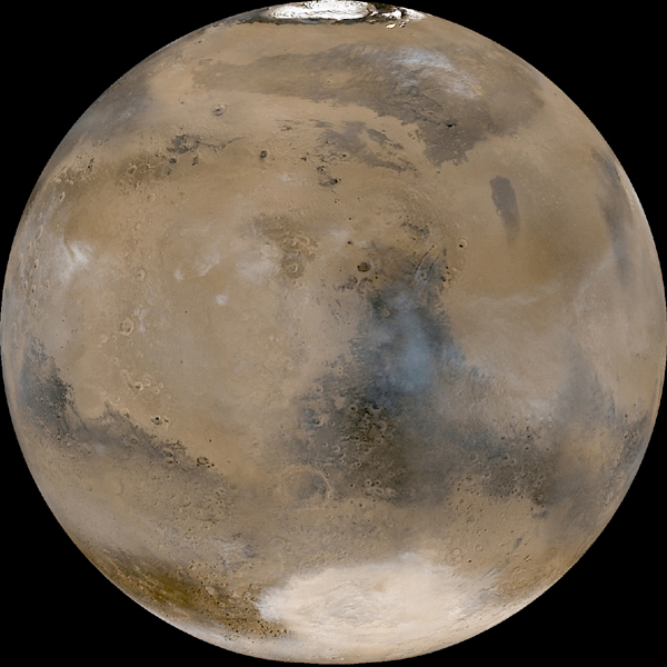
The south polar area contains a series of layered deposits thought to be composed mainly of frozen carbon dioxide (dry ice), dust and some recently discovered water ice. This photo shows the south polar cap of Mars at its smallest size of about 400 kilometers (249 miles). It looks reddish because of the Martian red dust that has been absorbed into it.
Volcanos, Mars and the Moon.
This website describes the volcanoes of Mars, which are the largest in our solar system. There is a wide spectrum of volcanic evidence on Mars ranging from cones, patera structures, volcanic planes and lava flows. There are less than 20 named volcanoes on Mars, 5 of which are giant shields. Volcanic activity really only occurs in 3 regions of Mars called Tharsis, Elysium, and Hellas Basin.
The website then goes on to explain the differences in age between Mars and the Moon. There are also descriptions between the ‘settings’ of Mars and the Moon. This website is awfully vague and I was not left convinced that the claims they made were actually true. I would not recommend visiting this site.
The website then goes on to explain the differences in age between Mars and the Moon. There are also descriptions between the ‘settings’ of Mars and the Moon. This website is awfully vague and I was not left convinced that the claims they made were actually true. I would not recommend visiting this site.
Sunday, October 28, 2007
Rock Diversity
For the next mission to Mars, NASA is being selective of their choice of landing site. They are seeking out a place with a high amount of rock diversity. It is their hope to find minerals that show evidence of water in the past in order to further learn about the water history on Mars. Images from the Compact Reconnaissance Imaging Spectrometer for Mars (CRISM) are providing lots of information for the selection of the landing site.
http://www.sciencedaily.com/releases/2007/10/071019171417.htm
http://www.sciencedaily.com/releases/2007/10/071019171417.htm
ICE!

New high resolution pictures of Mars are providing evidence that ice on Mars has a preference to certain latitudes, which in turn suggests that Mars has a latitude-dependent climate. Certain land features and debris on Mars give evidence for glaciers and there are similarities to the Arctic and Antarctic regions on Earth. James Head III described the process as "a quest to understand the Martian water cycle."
http://www.sciencedaily.com/releases/2007/10/071026095131.htm
Saturday, October 27, 2007
Martian and lunar soil simulate available to public

If astronauts are to properly prepare for the exploration of the Moon and Mars, they need to practice using materials that simulate the surface (regolith) they will land on. Now, for the first time, lunar and Martian soil simulates are available to NASA and the public. The company ORBITEC has been working since 2005 on the development and improvement of compounds that simulate Martian and lunar soil. A recent delivery of 45.000 pounds of lunar regolith stimulant and Martian soil stimulant was provided to engineers and scientists working on the development of mining equipment, robots, space suits and plant growth for use in outer space. The development of this soil stimulant will help scientists to better engineer the tools and machinery that is used in space. ORBITEC also developed the Astro and Space Gardens we see in so many home kitchens these days.
Friday, October 26, 2007
Detailed Picture of Mars With Ice
The main difference between Mars and Earth is that water on the Red Planet is rarely liquid and spends most of its time in gas or frozen form. There are pictures that reveal a range of ice-made features that show a strong preference to certain latitudes. Scientists used to have to study small postage-stamp size pictures, but can now rely on much better pictures to learn more about the mysterious planet. The signs of water ice are obvious at each of Mars' poles. However, as you move toward the equator, there is plenty of evidence that water ice had shaped the surface at one time. Not far from either pole, widespread bumpy polygonal patterned ground suggests the expansion and contraction of icy permafrost ground. This is very similar to Earth's Arctic and Antarctic regions. Even closer to the equator next to Mars' equatorial volcanoes are signs of glacial debris and small valleys which drop into canyons. On Earth this is a strong indication that a glacier once filled and shaped the canyon. Among the instruments used to study Mars are the Mars Global Surveyor's Laser Altimeter (MOLA) and Camera (MOC), the Mars Reconnaissance Orbiter's Context Camera (CTX) and High Resolution Imaging Science Experiment (HiRISE), and the Mars Express's High Resolution Stereo Camera (HRSC). These instruments have helped scientists in unlocking the secrets behind Mars' history. Below is a picture of the south polar region of Mars. Today's Martian polar caps were once titled toward the Sun more. This drove the ice to the lower latitudes, thus creating glaciers and other icy formations.
 http://www.sciencedaily.com/releases/2007/10/071026095131.htm
 http://www.sciencedaily.com/releases/2007/10/071026095131.htm
Top Ten Discoveries by Martian Rovers, Spirit and Opportunity

This article contains a pictorial tour complete with descriptions of the top ten discoveries by the robotic Martian rovers, Sprit and Opportunity. These rovers have allowed scientists to gain huge insight into the geology of Mars. Originally designed to explore Mars for just 3 months, these rovers continue to scour the surface for clues to the secrets of Mars 3 years after their arrival. Some of the top ten contributions of these rovers include…
*stunning visual images of Victoria Crater
*the presence of basaltic rock, hinting at ancient activity of water on Mars
*a meteorite resting on the ground (the first discovered on another planet)
*high concentrations of sulfur in Martian rocks
*film clips of dust devils, one of the few active processes that shape the surface of Mars in present times
*Hard evidence that Mars was once a wet planet
-silica rich soil
- ‘blueberries’ and rippled rock layers which could only be formed if water once flowed on the Martian surface
Thursday, October 25, 2007
Active Volcanoes on Mars?

A new article suggests that there may be at least three volcanoes on Mars that are dormant rather than extinct. Each of the suspected volcanoes are more than three times the size of the largest volcano on Earth, which is found in Hawaii. New studies of lava flows on Mars show that they may have been active within the last 2 million years. If an eruption is possible in the future - especially if all three were to become active again - I suspect this would have some substantial effects on the atmosphere of the planet due to the gases that would be emitted.
More Evidence Found for Water on Mars
Recent news from Mars furthers the theory of water on Mars. An orbiting spacecraft has sent back new evidence for the presence of water on Mars. Scientists long have debated whether water flowed on the red planet, with evidence increasing in recent years. The presence of water would raise the possibility of at least primitive life forms existing there.Images from a camera aboard NASA's Mars Reconnaissance Orbiter show alternating layers of dark- and light-toned rock in a giant rift valley. Within those deposits are a series of linear fractures, called joints, that are surrounded by "halos" of light-toned bedrock, according to researchers from the University of Arizona. The findings were published in Friday's edition of the journal Science, and were presented at the annual meeting of the American Association for the Advancement of Science in San Francisco. The researchers also said that layered outcrops can indicate cycles with materials deposited by regular episodes of water, wind or volcanic activity.
Exploring Mars
This article address the new spacecraft called Phoenix that is set to take off and land on an unexplored section of Mars, near the north pole. It is set to land this May.
Phoenix is equipped with a trenching tool that can dig down half a meter into the dirt--far lower than the few centimeters of previous missions--and a grinding tool that can penetrate even superhard ice. This mission should bring to light important details about the past geology and climate of the planet. For example, the shapes of particles can reveal whether they were exposed to flowing water, or were repeatedly frozen and thawed, or remained soaking in water for extended periods.
http://abcnews.go.com/Technology/story?id=3439041&page=1
Wednesday, October 24, 2007
Mars Express Image takes picture of shallow Maunder crater
The High Resolution Stereo Camera (HRSC) on ESA's Mars Express orbiter has obtained pictures of the Noachis Terra region on Mars, particularly the Maunder crater. The pictures were taken on two separate days, November 29th and December 15th, 2005. The impact crater, named after the British astronomer Edward W. Maunder, is located halfway between Argyre Planitia and Hellas Planitia on the southern Highlands of Mars. One reason why these images are important is that they exhibit hummocky terrain. This terrain exhibits small, irregularly-shaped hills and valleys. The hummocky terrain in the Maunder crater was formed by deposition of landslide debris.
http://www.marstoday.com/news/viewsr.rss.html?pid=25746
http://www.marstoday.com/news/viewsr.rss.html?pid=25746
Ice suggests a sea was once on Mars
That water flowed on Mars in the past is well known. The planet's landscape includes giant canyons and dry river valleys. The NASA Mars rovers have found geological evidence for bountiful water early in Mars' history, billions of years ago.The Mars Express images, however, are the first to offer clues that Mars has had large bodies of water in the geologically recent past. The scientists said the sea, which would have frozen quickly, was about the size of the North Sea and at least 150 feet deep.
Tuesday, October 23, 2007
The Mystery That is Mars
This article draws connections between Mars and Earth, focusing on three major puzzles: Martian volcanoes, martian river valleys, and Martian magnetic fields.
"In some ways Mars is strangely like Earth. It rotates in 24.6 hours and is tilted on its axis by 24 degrees, almost exactly the same as Earth. Its orbit wanders away from and toward the sun as much as Earth's does, giving Mars a range of climate rather similar to Earth, though much colder."
"In some ways Mars is strangely like Earth. It rotates in 24.6 hours and is tilted on its axis by 24 degrees, almost exactly the same as Earth. Its orbit wanders away from and toward the sun as much as Earth's does, giving Mars a range of climate rather similar to Earth, though much colder."
Monday, October 22, 2007
Mars Pictures
This website has many different interesting links about the exploration and colonization of Mars, but what I thought was most interesting and relevant to this class was the pictures provided on the home page. There are pictures of recent geological changes on Mars including sinking landforms and surfaces of Mars.
Sunday, October 21, 2007
Mars Missions
This website provides us with all the past, future, and current missions to Mars. It also descibes the resaon for the mission the destination, and launch and return dates.
This website also suggest different elementary art activities to help students understand the importance of understanding geology and how these facts help us complete the picture of Mars.
This website also suggest different elementary art activities to help students understand the importance of understanding geology and how these facts help us complete the picture of Mars.
Saturday, October 20, 2007
Bits of Halley's Comet to Rain Down Sunday Morning!!
Weather permitting and under very dark skies away from the light pollution, skywatchers could see several meteors per hour. Rates will be significantly lower in cities and suburban areas. This year, brilliant Mars, is nearby and is the apparent source of these meteors, called radiant, will be positioned roughly between Mars and Betelgeuse.
This meteor display is known as the Orionids because the meteors seem to fan out from the region to the north of Orion's second brightest star, ruddy Betelgeuse.
This meteor display is known as the Orionids because the meteors seem to fan out from the region to the north of Orion's second brightest star, ruddy Betelgeuse.
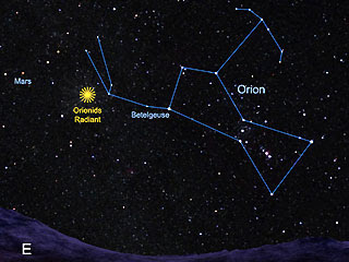
A good time to begin preparing for your meteor vigil, would be around 1:30 a.m. local daylight time on Sunday October 21. It will be at its best several hours later at around 5:00 a.m. when Orion is highest in the skky toward the south, Orinonids typically produce around 20 to 25 meteors per hour under a clear, dark sky. Orionid meteors are dim and can't be seen very well from urban locations, so if you want to be able to see the best Orionid activity, find a safe rural location!
Friday, October 19, 2007
Strong Evidence Proof of Mars Water
An article from The Globe and Mail discussed strong proof of water found on Mars by Canadian researchers. There is a white, salty substance that was churned up by the Mars Spirit rover that physicists at the University of Guelph say reinforces earlier evidence that there may be water trapped under the surface of Mars. The remnants represent oceans or pools that have since largely evaporated. The white substance was caught in Spirit's wheels as it moved across the soft red surface in the Columbia Hills region. An X-ray spectrometer on the arm of Spirit captured the data and transmitted it back to Earth. Professor Iain Campbell said, "I think it's a very important piece of the jigsaw that we've been able to supply. there were indicators for water. We've come along and said there's a new approach, a way to process the data you may have never thought were useful. They're telling you there's water."
Dust storms on mars tracked by Opportunity and Spirit
Since late June 2007, Mars has been having a series of regional dust storms. The dust raised by these individual storms has obscured most of the planet over the past few weeks. The two maps shown here are mosaics of images acquired by the Mars Reconnaissance Orbiter (MRO) Mars Color Imager (MARCI) on two days separated by about 3 and a half weeks.
Thursday, October 18, 2007
Spirit Arrives at Stratigraphic Wonderland!
The rover Spirit has just completed an extensive trek to an area scientists deem a ‘stratigraphic wonderland,’ a rocky area named “Texas Chili.” Rocks in the area will be analyzed with sophisticated instruments aboard the rover. The article then goes on to discuss the accomplishments of the rover prior to its current undertaking. A great deal of imagine and thermal emission spectrophotometry was accomplished by Spirit. The rover was also aiming to capture footage of dust devils with its navigation camera. Rock clasts and cloud formations were surveyed with panoramic cameras. Recently, Spirit scraped the surface of the Texas Chili area with a rock abrasion tool to acquire microscopic imaging. Spirit will continue to gather data about the area as well as take additional photos.
Mars Erupting
New evidence suggests that three volcanoes on Mars may be dormant and not extinct as was previously thought. This possibility has arisen from comparisons of Mars volcanoes to those in Hawaii. These Martian volcanoes are much bigger than those on Earth being around 186 miles across. Land features suggest that one of the volcanoes erupted relatively recently. It is the new images that are being taken of Mars' surface that are allowing these new inquiries. There is still a lot of missing data and unclear explanations that need to be worked out.
http://www.marsdaily.com/reports/Hawaii_Reveals_Steamy_Martian_Underground_999.html
http://www.marsdaily.com/reports/Hawaii_Reveals_Steamy_Martian_Underground_999.html
Crater Investigation

New pictures have come in from ESA's Mars Express orbiter of Maunder Crater (seen above) on Mars. While the crater was once larger than it is now, erosion has filled in some of the bottom. The floor of the crater is made up of dunes, hills, valleys, and gullies. The more we find out about Mars' geography and geology, the more we can learn about its past.
http://www.marsdaily.com/reports/Hummocky_And_Shallow_Maunder_Crater_999.html
Wednesday, October 17, 2007
Mars Pole Holds Enough Ice to Flood Planet, Radar Study Shows
Recent studies show evidence that the southern polar ice cap of mars contains enough water to cover the entire planet 36 feet (11 meters) deep if melted. This is the most accurate and precise calculation for the thickness of the planet's ice. The radar of the Mars express orbiter, revealed that the ice was surprisingly pure. The study also indicates that the polar ice cap may also contain just a little bit of frozen carbon dioxide, or dry ice. The research team also found a series of depressions buried beneath the ice only 180 miles (300 kilometers) from the pole. The amount of water in the ice cap is more than most scientists had expected, but not by a huge amount. And even when combined with the amount believed to reside at the planet's north pole, it's still only a small fraction of the water that scientists believe once existed on the red planet.
NASA Extends Mars Probes for 5th Time
An article posted by AFP reported Tuesday that NASA has announced that it will extend the Mars space probes Spirit and Opportunity for the fifth time. The two probes landed three weeks apart on Mars in January 2004. The mission was expected to only last 90 days, but NASA believes it could last until 2009. Opportunity has been exploring Victoria Crater, in the Meridiani Planum region of Mars since September. Spirit has been on the opposite side of the planet and is exploring the Home Plate volcanic plateau. This is where scientists believe the volcanic rock might contain traces of water. However, the rovers aren't getting any younger. "After more than three-and-a-half years, Spirit and Opportunity are showing some signs of aging, but they are in good health and capable of conducting great science," said John Callas, the rover project manager at JPL. The rovers carry sophisticated instruments that help NASA to examine the geology of Mars for information about prior environmental conditions. Opportunity has returned evidence that its area on Mars stayed wet for a long period, with conditions that may have been ideal for sustaining microbial life. Spirit has shown evidence that water in some form has changed the composition of the soil and rocks.
To date, Spirit has driven 4.51 miles and has sent back over 102,000 images. Opportunity has driven 7.19 miles and has returned over 94,000 images.
To date, Spirit has driven 4.51 miles and has sent back over 102,000 images. Opportunity has driven 7.19 miles and has returned over 94,000 images.
Tuesday, October 16, 2007
Views of the Martian Surface
This site provides you with a visual tour of the Martian surface as seen by the Viking 1 Mars lander. The surface of Mars is visible from a robotic-eye-view. Its pretty neat! Pictures of the first Martian 'dune-buggy,' Sojourner are visible. This Mars mission is a bit outdated, but the photos really give you a great perspective of what the Martian surface looks like.
There's definitely a lot of rocks....some serious geological wonders!
There's definitely a lot of rocks....some serious geological wonders!
Monday, October 15, 2007
Space.com's 10 Best Mars Images
I just found this article on Space.com about the 10 best images of Mars. It was written in 2002, so there are obviously more images now, but this is still an interesting read.
http://www.space.com/scienceastronomy/solarsystem/mars_best_021203-1.html
http://www.space.com/scienceastronomy/solarsystem/mars_best_021203-1.html
Some High resolution images of Mars: Taken in 2003
Center longitude: 180° W
Center longitude: 120° W
Center longitude: 60° W
Center longitude: 0°
Center longitude: 300° W
Center longitude: 240° W
A Mid-Northern Summer/Southern Winter's MarsMGS MOC Release No. MOC2-325, 04 April 2003
Center longitude: 120° W
Center longitude: 60° W
Center longitude: 0°
Center longitude: 300° W
Center longitude: 240° W
A Mid-Northern Summer/Southern Winter's MarsMGS MOC Release No. MOC2-325, 04 April 2003
Frozen Water and the Southern Pole
A team of research scientists based out of MIT have determined that the Southern Pole of Mars contains the largest deposit of frozen water in the inner solar system (besides Earth). It is important to note that they determined that water and not CO2 is the most abundant frozen liquid on Mars. A thin crust of CO2 rests above layers of dust and ice on the pole, and it was previously unknown if additional deposits of CO2 are present. Scientists were also suspicious since the atmosphere of Mars is composed of 95% CO2, it has been hypothesized that the polar caps were frozen CO2. Measurements of density were used to calculate the composition of the pole, which was found to be mostly frozen water with about 15% dust and silicate. Density data was gathered from topographic and gravitational data collected by 3 Mars orbiters.
Scientists are now wondering why much of the Southern pole is covered in a layer of dust, and why this dust only covers certain areas. A study is currently underway to determine the densities of the Northern pole.
Scientists are now wondering why much of the Southern pole is covered in a layer of dust, and why this dust only covers certain areas. A study is currently underway to determine the densities of the Northern pole.
Saturday, October 13, 2007
Heat Sensing camera senses possible cave skylights on Martian Volcano...
Seven, small deep holes on the slope of Arsia Mons, a giant Martian volcano, have recently been detected with a heat-sensitive camera aboard the NASA Odyssey orbiter. There is speculation that the holes may be openings, called skylights, forming the ceilings of underground caves. Images were taken at infrared wavelengths with the Thermal Emission Imaging System, (THEMIS), designed by Arizona State University.
The holes are dark and approximately circular, ranging from 100-250 meters in diameter. The volcano Arsia Mons was visualized at night with the THEMIS to detect any anmoulus ‘warm spots.’ Locations found to contain thermal heat were examined in daylight conditions and found to contain the holes. It has been suggested that the holes were the creation of stresses from faults that opened spaces underneath the surface.
The holes are dark and approximately circular, ranging from 100-250 meters in diameter. The volcano Arsia Mons was visualized at night with the THEMIS to detect any anmoulus ‘warm spots.’ Locations found to contain thermal heat were examined in daylight conditions and found to contain the holes. It has been suggested that the holes were the creation of stresses from faults that opened spaces underneath the surface.
Friday, October 12, 2007
Does Mars Methane Indicate Life Underground?
Information/data obtained by the Mars Express probe indicate water vapor and methane gas are concentrated in the same regions of the Martian atmosphere, according to the European Space Agency. This is important because there is evidence suggesting that microbial life could exist on Mars. If microbes are making methane in the Martian atmosphere as part of their living process, they would rely on water. Other scientists disagree however. They argue that the new methane measurements are real and statistically valid. Even if there is evidence of methane gas and water vapor, they could easily be explained by other processes. However, there is a possibility that the methane is produced by organisms called methanogens, which are microbes that produce methane as a waste product of their life process. The gas would be released to the surface and into the atmosphere.
Thursday, October 11, 2007
Mars in Color

NASA's Mars Reconnaissance Orbiter is now seeing in color. What were once black and white photos are now in color like the one on the left. While not the colors may not be the colors that we would see through our eyes, they make viewing landscapes on Mars easier. These pictures are helping to find a good landing site for NASA's Mars Science Laboratory as well as adding detail to maps of soil and minerals.

The video below animates some of these new pictures.
http://www.marsdaily.com/reports/HiRISE_Releases_Color_Images_Movie_Of_Prospective_Landing_Sites_On_Mars_999.html
Underground caves on Mars
Large black spots possible the size of a football field have been discovered on the surface of Mars. This specific hole shown was found on the slope the the volcano Arsia Mons. It is suggested that these holes could possible be entrances to deep underground caves, that are capable of protecting Martin life...
Wednesday, October 10, 2007
HiRISE Releases Color Images, Movie of Prospective Landing Sites on Mars
The High Resolution Imaging Science Experiment, or HiRISE, on NASA's Mars Reconnaissance Orbiter has added the dimension of color to its views of Mars. The University of Arizona-based HiRISE released 143 color images today. These images are valuable to researchers who are studying possible landing sites for future Mars exploration missions. These color images can be viewed at this URL: http://hirise.lpl.arizona.edu.
HiRISE is also releasing a color movie, which scrolls over one potential Mars Science Laboratory landing site in Nili Fossae, at 21 degrees north latitude and 74 degrees east latitude. The movie depicts several interesting land features that includes hydrated clay minerals and unaltered volcanic rocks. "The clay minerals are especially promising in the search for ancient life on Mars," said UA Professor Alfred S. McEwen, HiRISE principal investigator. The movie can be viewed here: http://hirise.lpl.arizona.edu/media/clips/PSP_003086_2015_short.mov
HiRISE is also releasing a color movie, which scrolls over one potential Mars Science Laboratory landing site in Nili Fossae, at 21 degrees north latitude and 74 degrees east latitude. The movie depicts several interesting land features that includes hydrated clay minerals and unaltered volcanic rocks. "The clay minerals are especially promising in the search for ancient life on Mars," said UA Professor Alfred S. McEwen, HiRISE principal investigator. The movie can be viewed here: http://hirise.lpl.arizona.edu/media/clips/PSP_003086_2015_short.mov
Tuesday, October 9, 2007
Monday, October 8, 2007
MARSIS gauges water around south pole
The instrument, named the Mars Advanced Radar for Subsurface and Ionospheric Sounding (MARSIS), has created a new estimate of possible water usage by mapping the thickness of ice. It has made more than 300 slices through the layers coving the south pole. This has allowed us to achieve knowledge about the possibility of liquid water and therefore to possiblity of life
Humorous Mars Video
This is an animated video depicting what the Mars surface will look like in the year 202o in the Springtime. It touches on how so many Mars probes have failed. I found it to be pretty funny. Check it out:
http://youtube.com/watch?v=yjiGH9QNiU0
http://youtube.com/watch?v=yjiGH9QNiU0
Saturday, October 6, 2007
Scientist sees Earth/Mars-like planet forming
About 425 light years away from us is a binary star system called HD 113766 - where one scientist believes an inhabitable, terrestrial planet is forming around one of the stars. According to the scientist who has made the discovery, the new planet is likely to be like Earth or Mars in size and location in its own solar system. The two stars in the system are similar to our Sun except they are both just slightly bigger and brighter, which makes them ideal for a livable planet. Plus, the planet is forming right in the middle of the inhabitable zone - where the distance from the star makes for the perfect conditions for water and other conditions that are required to support life.
There is no planet there yet - there is just a dust ring around one of the stars where planets are beginning to accumulate. Apparently, the star is just the right age to create rocky planets instead of huge gas giants at the inner part of the system. This is a pretty significant find if he is right, because most of the planets that astronomers find seem to be gas giants because they are so much bigger and easier to see. If we manage to leave Earth and colonize planets across the galaxy (and therefore still exist as the human race in 3-5 billion years when intelligent life has time to have developed on the new planet) maybe we can go over and meet our new neighbors...
There is no planet there yet - there is just a dust ring around one of the stars where planets are beginning to accumulate. Apparently, the star is just the right age to create rocky planets instead of huge gas giants at the inner part of the system. This is a pretty significant find if he is right, because most of the planets that astronomers find seem to be gas giants because they are so much bigger and easier to see. If we manage to leave Earth and colonize planets across the galaxy (and therefore still exist as the human race in 3-5 billion years when intelligent life has time to have developed on the new planet) maybe we can go over and meet our new neighbors...
Friday, October 5, 2007
Spirit and Opportunity
This short documentary portrays the difficulties and struggles in 2003 pertaining to the launch of Spirit and Opportunity, two rovers to Mars. It shows the emotions and energy that goes into launching these two rovers. It also shows how unpredicatable Mars can be. Plan for the best, prepare for the worst...
Thursday, October 4, 2007
Mars rover finds "puddles" on the planet's surface
 Recent pictures taken by the rover Opportunity has revealed small ponds of liquid water on the surface of Mars. The report identifies specific spots that appear to have contained liquid water two years ago, when Opportunity was exploring a crater called Endurance.
Many scientists are pessimistic however, because they believe that liquid water cannot exist on the surface of Mars because of its thin atmosphere. If these claims are true however, it would boost the odds that living organisms could survive on or near the surface of Mars, says physicist Ron Levin, who works in advanced image processing at the aerospace company in Lockheed Martin in Arizona.
Raging dust storm halts Mars rover's progress
A huge dust storm has broken out on Mars, cutting solar power to NASA's Opportunity rover and preventing it from starting its planned descent into Victoria crater. The current dust storm is the most severe ever to effect Spirit and Opportunity. Dust storms reduce the amount of power available to the rovers. John Callas of NASA's Jet Propulsion Laboratory in Pasadena, U.S. said, "If the dust levels were to increase further and stay elevated for several days, there is a risk to how well Opportunity could continue to work in this darkened environment." The rover team has now been forced to hold off the descent until further examination of this storm is studied. On a positive note, the wind has removed some of the dust that was stuck to the solar panels of the rovers, which prevented them from generating the maximum power.
Monday, October 1, 2007
View of Victoria Crater from Duck Bay

This article describes a recent image taken by the Mars Exploration Rover, Opportunity. This image was taken by Opportuinity and provides a view of Victoria Crater from Duck Bay. Opportunity descended into Victoria Crater on September 27, 2007, a journey of 5.77 miles from its landing site at Eagle Crater. Victoria Crater is larger than both Endurance Crater and Eagle Crater. In this image, the layered south face of the 20 foot tall Cape Verde promontory is located in the left side of the inner crater wall. The north face of the 50 foot tall stack of layered rocks is termed Cabo Frio and can be seen on the right side of the inner crater wall
Mysterious Dark Pit
The HiRISE instrument onboard the the Mars Reconnaissance Orbiter found this mysterious dark pit:

The pit is about 150 meters in diameter and is located on the north slope of the martian volcano Arsia Mons. It is suspected that this pit leads to an underground cavern at least 78 meters deep.
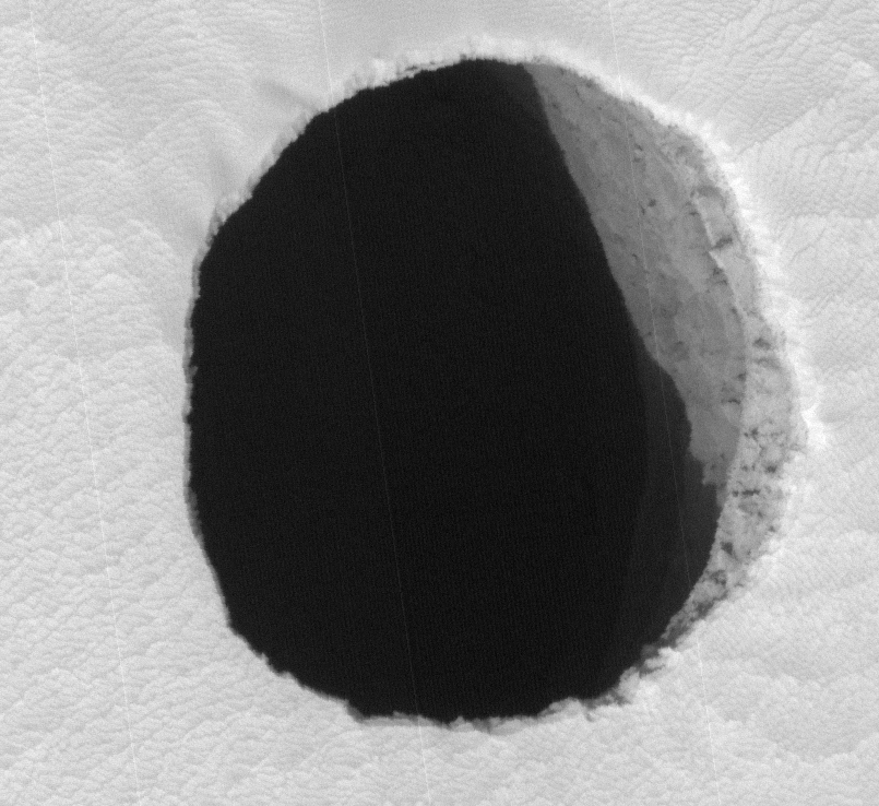
The pit is about 150 meters in diameter and is located on the north slope of the martian volcano Arsia Mons. It is suspected that this pit leads to an underground cavern at least 78 meters deep.
Mars will be in best viewing position Wednesday night
This article, by Joe Rao, a Space.com Skywatching Columnist, says that on Wednesday night (or very early Thursday morning) Mars will be in the best viewing position it will provide us until the year 2014. Rao states that Mars is currently midway between the constellations of Taurus, the Bull and Gemini, and the Twins. It will rise shortly after 11:00 PM standard daylight time. If you haven't checked the Red Planet out, now would be the time. It will continue to get brighter throughout the coming weeks and months until, on December 9th, it will surpass Sirius, the brightest star in the sky, in brightness. Rao says that by this time Mars will even almost match Jupiter in brilliance.
http://www.space.com/spacewatch/070928_ns_mars_watch.html
http://www.space.com/spacewatch/070928_ns_mars_watch.html
Saturday, September 29, 2007
The mysterious ridges at the mouth of Tiu Valles

This article describes images taken by a high resolution stereo camera on board the Mars Express which have captured a channel system at the mouth of the Tiu Valles on Mars. This landform is unique in that it displays characteristics typical of the tidal effects found in an estuary on Earth. The exact geological processes that formed these landforms remain unknown. A possible explanation is that during floods, water or water-rich surface layers contacted lava from surrounding areas and formed the mysterious ridges. The landforms of the Tiu Valles also contain large-scale massifs, or large relief masses that have moved and weathered as a block. These particular massifs are heavily eroded. The Tiu Valles terminate in the Chryse Planitia plain.
Meridiani Planum: "Drenched"
Strong supporting evidence of water once being on Mars is found. Near Mars rover Opporunity's landing site in Meridiana Planum some rocks were found that showed evidence of long standing periods in liquid water. "Liquid water once flowed through these rocks. It changed their texture, and it changed their chemistry," said Cornell University's Steve Squyres, the principal investigator for the science instruments on Opportunity and its twin, Spirit. "We've been able to read the tell-tale clues the water left behind, giving us confidence in that conclusion." Spectrometers aboard the rover recorded the presence of salts that could only form in water. Also cameras found evidence of "vugs" which are cracks in rock that form when salt crystals grown in rock soaked in liquid water then the salt erodes to leave the cracks. Finally they found "blueberries" which form with the accumulation of minerals on water soaked rocks.
Friday, September 28, 2007
NASA: "Man on Mars by 2037"
Here is an interesting article. It talks about NASA's goal to put man on Mars by the year 2037, as stated by the administrator of the US Space Agency. Their plan includes using the international space station that is being built in orbit as a middle-point, where "humanity can travel first to the Moon and then to Mars." NASA administrator Michael Griffin said, "We are looking at the Moon and Mars to build a civilization for tomorrow and after that." He continued to say that in 2057, we should be celebrating 20 years of man on Mars. I hope they stay on schedule, because that would be totally awesome to go to Mars.
http://www.marsdaily.com/reports/NASA_aims_to_put_man_on_Mars_by_2037_999.html
http://www.marsdaily.com/reports/NASA_aims_to_put_man_on_Mars_by_2037_999.html
Good maps
For those of you who actually read these, here are some really cool, Hi-res maps of Mars.
Valles Marineris
Syrtis Major
Cerberus
It makes you realize how much of a dust ball the planet really is.
Valles Marineris
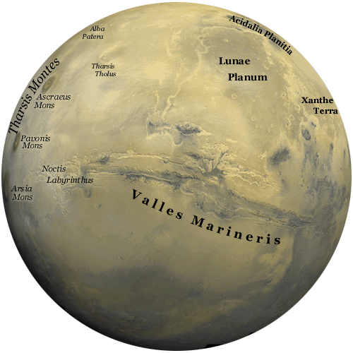
Syrtis Major
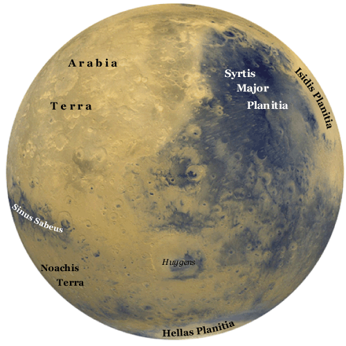
Cerberus
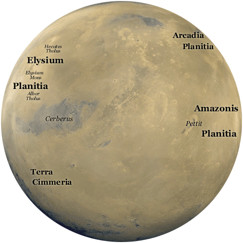
It makes you realize how much of a dust ball the planet really is.
"In the summer time...
... when the weather is hot. You can reach right up and touch the sky..."
(Then there is a bit about having women on your mind. I don't think that that applies to the post as much...) This is a cool picture, taken by the Mars Global Surveyor, of the north polar cap in the Martian summers of 1999 and 2001 (which makes sense because its year is about twice our own.) This is the first really good image I've seen of the poles. And looking at it I can deffinitely see why people would think that this is ice/snow. It certainly looks like it.
(Then there is a bit about having women on your mind. I don't think that that applies to the post as much...)
This is a cool picture, taken by the Mars Global Surveyor, of the north polar cap in the Martian summers of 1999 and 2001 (which makes sense because its year is about twice our own.) This is the first really good image I've seen of the poles. And looking at it I can deffinitely see why people would think that this is ice/snow. It certainly looks like it.
Thursday, September 27, 2007
A New Dawn
NASA is not focusing completely on Mars exploration, but looking past Mars as well. The Spacecraft Dawn was launched Thurs. Sept. 27 with a destination of the asteroid belt past Mars. Its mission is to explore Vesta a large asteroid and Ceres a dwarf planet. The trip is a long ways, however, and Dawn will not reach Vesta until 2011 and Ceres in 2015. It will take readings on different geographical and composition features.
http://www.sciencedaily.com/upi/index.php?feed=Science&article=UPI-1-20070927-10525100-bc-us-dawn.xml
http://www.sciencedaily.com/upi/index.php?feed=Science&article=UPI-1-20070927-10525100-bc-us-dawn.xml
Subscribe to:
Comments (Atom)