Saturday, September 29, 2007

The mysterious ridges at the mouth of Tiu Valles


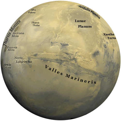
This article describes images taken by a high resolution stereo camera on board the Mars Express which have captured a channel system at the mouth of the Tiu Valles on Mars. This landform is unique in that it displays characteristics typical of the tidal effects found in an estuary on Earth. The exact geological processes that formed these landforms remain unknown. A possible explanation is that during floods, water or water-rich surface layers contacted lava from surrounding areas and formed the mysterious ridges. The landforms of the Tiu Valles also contain large-scale massifs, or large relief masses that have moved and weathered as a block. These particular massifs are heavily eroded. The Tiu Valles terminate in the Chryse Planitia plain.

Meridiani Planum: "Drenched"

Strong supporting evidence of water once being on Mars is found. Near Mars rover Opporunity's landing site in Meridiana Planum some rocks were found that showed evidence of long standing periods in liquid water. "Liquid water once flowed through these rocks. It changed their texture, and it changed their chemistry," said Cornell University's Steve Squyres, the principal investigator for the science instruments on Opportunity and its twin, Spirit. "We've been able to read the tell-tale clues the water left behind, giving us confidence in that conclusion." Spectrometers aboard the rover recorded the presence of salts that could only form in water. Also cameras found evidence of "vugs" which are cracks in rock that form when salt crystals grown in rock soaked in liquid water then the salt erodes to leave the cracks. Finally they found "blueberries" which form with the accumulation of minerals on water soaked rocks.

Friday, September 28, 2007

NASA: "Man on Mars by 2037"

Here is an interesting article. It talks about NASA's goal to put man on Mars by the year 2037, as stated by the administrator of the US Space Agency. Their plan includes using the international space station that is being built in orbit as a middle-point, where "humanity can travel first to the Moon and then to Mars." NASA administrator Michael Griffin said, "We are looking at the Moon and Mars to build a civilization for tomorrow and after that." He continued to say that in 2057, we should be celebrating 20 years of man on Mars. I hope they stay on schedule, because that would be totally awesome to go to Mars.

http://www.marsdaily.com/reports/NASA_aims_to_put_man_on_Mars_by_2037_999.html

Good maps

For those of you who actually read these, here are some really cool, Hi-res maps of Mars.

Valles Marineris
Syrtis Major
Cerberus

It makes you realize how much of a dust ball the planet really is.

"In the summer time...

... when the weather is hot. You can reach right up and touch the sky..."
(Then there is a bit about having women on your mind. I don't think that that applies to the post as much...) This is a cool picture, taken by the Mars Global Surveyor, of the north polar cap in the Martian summers of 1999 and 2001 (which makes sense because its year is about twice our own.) This is the first really good image I've seen of the poles. And looking at it I can deffinitely see why people would think that this is ice/snow. It certainly looks like it.

Thursday, September 27, 2007

A New Dawn

NASA is not focusing completely on Mars exploration, but looking past Mars as well. The Spacecraft Dawn was launched Thurs. Sept. 27 with a destination of the asteroid belt past Mars. Its mission is to explore Vesta a large asteroid and Ceres a dwarf planet. The trip is a long ways, however, and Dawn will not reach Vesta until 2011 and Ceres in 2015. It will take readings on different geographical and composition features.
http://www.sciencedaily.com/upi/index.php?feed=Science&article=UPI-1-20070927-10525100-bc-us-dawn.xml

Trekking Around Mars

Rover Opportunity on Mars is in the process of exploring Victoria Crater. The rover is looking for evidence of how the crater was formed. The rover has been operative for over 1,300 Martian days which is well beyond its projected 90 days. It is amazing how every small action on Mars for the rover can take days. For example on Sept. 22, Opportunity moved eight whole feet bested by its 24 foot move on Sept. 18. The rover is preparing to begin exploring the contents of the crater with its robotic arm.
http://www.marsdaily.com/reports/Opportunity_Reaches_First_Target_Inside_Crater_999.html

ice crater

This video I though gave a really clear and up close picture of a crater inwhich a ice cap was located. I am unsure where this is located on Mars but thought it was really interesting.

Wednesday, September 26, 2007

So what if there was a lake on Mars

After taking satellite images of Mars, Scientists have found sedimentary rock, this formation of rock suggests lakes on some body of water. A geologists heaven is sedimentary, there are usually many fossils in between the layers of rock .

"I have not previously been a vocal advocate of the theory that Mars was wet and warm in its early history. But my earlier view of Mars was really shaken when I saw our first high-resolution pictures of Candor Chasma [a region of Mars]. The nearly identically thick layers would be almost impossible to create without water."

NASA Mars Reconnaissance Orbiter Provides Insights About Mars Water and Climate

This article explains the activity of the Mars Reconnaissance Orbiter (MRO), which has recently been investigating features of the Martian surface that could help to illustrate the role of water during different ages in history. The orbiter examined material deposited in two gullies within the last year, which have generated hypotheses that modern flows of liquid water had been detected. The MRO was able to determine that these deposits were not the result of the action of water, but the debris of a dry landslide. One feature of the gully in particular, a stripe of bright material several hundred yards long that appeared sometime before 2004, was thought to be frost, ice, or a mineral product of evaporation of salty water. The MRO found bright material uphill from the stripe, indicating that the feature may be the remains of a landslide.
Other images from the high-resolution camera aboard MRO have, however, found other gullies with similar patterns whose slopes are too shallow to allow dry landslides. The cameras found clear indications of liquid flow such as braided channels and terraces in the gullies as well as fan-like deposits characteristic of river deltas. Images have also found landscapes that appear to have been shaped by water in conjunction with ‘ponded’ deposits which have been interpreted as material that melted as the result of a meteoritic impact with an icy crust. This evidence supports the idea that the presence of water on mars is episodic and unlinked to precipitation.
The MRO has also examined layers near the Martian poles with radar to detect the presence of ice. The radar discovered layering patterns near the South Pole that indicate climatic periods of accumulation of deposits alternating with periods of erosion. The information gathered by the MRO further illustrates the need for further exploration of the Martian surface and soil to better understand the dynamics of water on the Red Planet.

"Seven Sisters" Found on Mars Surface


An article from news.com, discussed the new discoveries on the Martian surface today. The Mars Odyssey Spacecraft has detected the openings of seven caves on a volcano named Arsia Mons. Infrared cameras have detected that the opening is cooler than the surrounding areas in the afternoon (above, middle) and warmer than the surrounding areas at night (above, right).

The above picture is of one of the seven caves and has been named "Annie". Six other cave entrances have been found on Arsia Mons and together they are being called the "Seven Sisters" (below). The high altitude of the caves make it unlikely that they could be used for human shelter, but who knows what could be hiding inside of them?

The press release from NASA may be seen here:

http://www.nasa.gov/mission_pages/odyssey/odyssey-20070921.html

MIT observations give precise estimate of Mars surface ice

An MIT-led team on scientists has found that water is the predominant frozen liquid on the Southern Pole of Mars. Maria Zuber, an MIT professor of geophysics, said that scientists have long suspected that this pole was predominately frozen carbon dioxide, and not water, because Mars' atmosphere is 95% carbon dioxide with only traces of water. These scientists also found that this pole on Mars contains the largest deposit of frozen water in the inner solar system, outside of Earth. This discovery was made by calculating the density of the composition of the Southern polar cap.

http://www.marstoday.com/news/viewpr.html?pid=23617

Tuesday, September 25, 2007

Scary Storm on Mars could Doom Rovers

Space programs are currently worried about giant dust storm that could potentially prevent rovers from landing on Mars for future space missions. This dust storm covers almost the entire southern hemisphere. Now a threat of a second large dust storm further adds to the complications. The first storm reduced reduced direct sunlight by nearly 99 percent. There is huge controversy whether the rovers would have enough power during the day. However many scientists are still optimistic about the future. "The worst case scenario is that enough dust in the sky decreases solar energy to the point that we have to shut down too many things to save power. The rovers keep their battery alive by keeping their electronics alive." Lemmon said. Only further tests and time will tell whether the rover missions will commence as planned.


This short article provides evidence of that Mars has undergone plate tectonics. The evidence is
a high resolution magnetic field map that covers the surface of Mars. This map displays "magnetic strips" which scientists believe is proof.

Monday, September 24, 2007

NASA Mars Reconnaissance Orbiter Video: Simulated Flight over Gullied Crater

This is a video of a simulated flight over a gullied crater in the Centauri Montes region of Mars. NASA is interested in this region because one of the gullies inside the crater has a deposit of light-toned material that was not present in 1999 but appeared in 2004, according to before-and-after images taken by the Mars Orbiter Camera on NASA's Mars Orbital Surveyor. This unknown deposit in several hundred yards or meters long and could hold valuable information regarding the history of Mars' climate and geography.

Here is the link:

http://www.nasa.gov/mov/189979main_mro-flyover092007-320.mov

Search for Water on Mars with Sharp New Images from the Mars Reconnaissance Orbiter

This article declares that new images taken by the Mars Reconnaissance Orbiter (MRO) illustrates that geographical features once thought to have been carved by flowing water can be attributed to other geological events. While these photos do not confirm that liquid water has never existed on the planet, the bright deposits thought to have been created by water were in fact probably created by dry landslides. The slopes above the deposits are steep enough to facilitate sand and dust to flow down into the gullies. The images provided by MRO do not indicate any strong evidence for the existence of water.
The article then goes on to describe the equipment of MRO that has provided unprecedented high-resolution images of the Martian surface. The MRO is helping to provide better understanding of the geography of Mars and to assist in the search for signs of the presence of liquid water in the geologic past. For example, features of the Athabasca Valles once thought to be the outcome of erosion from water can now be traced to lava flow thanks to the high-resolution images collected by the MRO. The cone-shaped features found on the Athabasca floor can be attributed to steam explosions that occurred when water and lava interacted. This is an indication that the lava-covered ground may have contained ground ice, and when the ice heated, steam exploded trhough the lava creating the cones.
Other images collected by the MRO also rule out the hypothesis that Mars once harbored an ancient ocean. The Vastitas Borealis Formation was once thought to contain fine-grained deposits left over by an ancient sea, but the new images from MRO reveal that the area is a flat, featureless plain covered with large boulders. While the images collected by MRO do not provide strong evidence for the presence of water on Mars in geologically recent times, this does not mean that water on Mars does not exist. Scientists continue to search for water locked in the poles of Mars.

Saturday, September 22, 2007

Exploration of Geography in Athabasca Valles

On this site NASA has provided images gathered by the Mars Reconnaissance Orbiter on April 4, 2007 of a Martian valley, Athabasca Valles. The video provides an aerial tour of what might be the yongest outflow channel on Mars. The high resolution images provided by the Reconnaissance Orbiter indicate that the Athabasca Valles is covered in a thin layer of lava. The presence of this layer indicates that a volcanic fissure eruption distributed lava through the channels in the valley in geologically recent times. The Athabasca Valles is located about 10° north latitude and 156° east longitude. (I could not get the video to load on the blog properly, so visit the site to check it out!)

Friday, September 21, 2007

NASA Mars Odyssey Finds Possible Cave Skylights on Mars

Mars Odyssey has found what appears to be caves on the surface of Mars. This is exciting for many who think that this could provide a new less harsh environment for life on Mars. The temperatures in the caves seem to be less extreme being cooler in the day and warmer at night than surface temperatures. While the holes that have been found are at a high altitude on one of Mars' volcanoes and would not be able to support human life, it does provide hope for the discovery of similar geological features elsewhere on the planet.

This rover has recorded the land formations from the rear view, it allows you to take a closer look at the craters, valleys, and such then we have had in class. I am not sure if I uploaded the video correstly but I tried. More vidoes available on website.

Thursday, September 20, 2007

Like Earth Like Mars

This article is an easy read comparing the surfaces of Mars and Earth.

Analyzing Earth rock samples using a spectrometer in the laboratory is one thing, but to compare the rocks with those on Mars, Christensen the scientist has to find out which minerals are present in Martian rocks. For that, he has helped to design different spectrometers that have been sent to Mars on NASA spacecraft.

NASA Mars Rovers Survive Severe Dust Storms, Ready for Next Objectives

This article outlines the severe global dust storms on Mars that have hindered the progress of the two Mars exploration rovers, Spirit and Opportunity. Since the rovers are solar powered, they were forced to wait 2 months for the dust storm to pass over. Dust had collected on the solar panels of the rovers, hindering their solar energy intake. Gusts of wind helped to clear the solar panels of debries. Currently, Opportunity is now on course for the decent into Victoria Crater. The two rovers endured intense conditions throughout the storm, and are now continuing groundbreaking research on Martian geology.
Opportunity may have sustained damage to its microscopic imager, Mini-TES, during the storm, which would prevent NASA scientists from utilizing that instrument for data collection. Instead of relying on Mini-Tes to collect valuable data about Martian rocks and soils, Opportunity will use its alpha particle X-ray spectrometer to learn more about the band of rocks within the Victoria Crater.

Wednesday, September 19, 2007

No Lakes on Mars,

But there might be seas.

That, of course, is a hyperbole but it illustrates a newly found piece of information concerning the ever lusted after martian water. Untill recently it was assumed that liquid water couldn't exist on mars due to the extremem temperatures and the lower atmospheric pressure. It was postualted that there could certainly be liquid water on mars, but the problem is that it doesn't stick around long enough for us to find it. The water spends almost no time in the liquid state; rather, it goes nearly directly from solid to gas.

However, reshearchers at the University of Arkansas have been testing salt water brines in martian conditions in a planatary atmosphere chamber and have found that salt water can stay liquid at much coler temperatures and this means that it has a bigger chance of being found. It's interesting that people didn't think of this earlier seeing as the majority of the water on earth is salt water. So it isn't out of the realm of reasonability that there might be similar distrobutions on mars. This just gives us little more hope in finding liquid water on mars which can be used by future explorers and possibly contains life.

Check out the artical at space.com "Water Could Stay Liquid on Mars" url: http://www.space.com/scienceastronomy/051115_science_tuesday.html

Monday, September 17, 2007

Opportunity dives into Victoria Crater

The Martian rover Opportunity took its first dive into Victoria Crater on mars recently, after a quick in-and-out slippage test was performed to ensure a safe exit. John Callas, the Mars rover project manager at NASA's Jet Propulsion Laboratory, cited that he wanted to "maintain a safe egress route out of the crater for Opportunity" before any extensive exploring was conducted. Opportunity's exploration of this crater may prove to be highly beneficial to the Mars rover project, as it is exploring a light-toned layer of exposed rock that might preserve evidence of interaction between the Martian atmosphere and the surface from millions of years ago.

The full text of this article can be viewed at this link:

http://www.space.com/scienceastronomy/070914_victoria_opp.html

History in the Rocks of Mars

This is a very short article on the possible information that can be discovered through the geology of Mars. Analyzing rocks and minerals can help formulate a historic timeline on discovering what has been happen on Mars. This information will help us realize what is possible and will happen on Mars in the furure.

http://mars.jpl.nasa.gov/science/geology/

Saturday, September 15, 2007

Wobbling Ice Ages

So it turns out that Mars has more than it's fair share of ice ages. 40 significant ones in the past 5 million years. Which doesn't seem like that much untill you compare this with the earths yeild: 3 in the past billion. (I'm aware that this may be slightly skewed as these are two different sources and their criteria for "significant" might be a little different).

This frequent freezing seems to have something to do with the extreme wobbles in Mars' rotational axis. As the different portions of the planet are bombarded by larger or small percentages of the suns rays due to these wobble it makes for exremem shifts in the amount of ice under or near the surface of the planet. The earth doesn't have this effect because the gravitational pull of the moon keeps our axis relatively wobble free.

There are a few things that make this interesting:

1. The fact that water/ice is having cycles means that there might be more ice in areas less close to the pole. This means that we don't have to be as exact in our mars landings.

2. It also gives ome insight into how Mars, which was originally very similar to earth, might have made the detour in to the frozen dirt ball that is now (I mean no offence to Mars, but in comparison to earth? It's what it is.)

The rest of the article, "Wobbles of Mars Produced 40 Ice Ages" it's a quick interesting read.